Have you ever used a map to find a new place or followed directions on a mobile phone while travelling? Maps have guided explorers, sailors, travellers, scientists, and adventurers for thousands of years. They help us understand where we are, where we want to go, and what lies around us. From ancient hand-drawn maps to modern digital navigation systems, maps have played a vital role in connecting people and discovering the world. Learning about maps teaches children the importance of geography, observation, and exploration.
A map is a drawing or representation of the Earth’s surface or a part of it. It shows the locations of countries, states, cities, rivers, mountains, roads, forests, oceans, and many other important features. Maps help people understand distances, directions, and the relationships between different places. Without maps, travelling would be much more difficult, especially in unfamiliar areas.
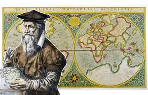
The earliest maps were created thousands of years ago by ancient civilizations. Early people drew simple maps on rocks, animal skins, and clay tablets to show rivers, hunting grounds, and villages. As trade and exploration increased, maps became more detailed. Famous explorers such as Christopher Columbus, Vasco da Gama, and Ferdinand Magellan depended on maps and navigation tools to travel across oceans and discover new lands.
There are many different types of maps, each designed for a specific purpose. Political maps show countries, states, cities, and national boundaries. Physical maps display natural features such as mountains, rivers, deserts, forests, and oceans. Road maps help drivers find highways, streets, and important landmarks. Weather maps show temperatures, rainfall, clouds, and wind patterns, while topographic maps use contour lines to represent the height and shape of the land.
Every map contains important elements that make it easy to read. A title explains what the map shows, a scale indicates the relationship between distances on the map and actual distances on the ground, and a legend or key explains the symbols used. Most maps also include a compass rose, which shows the four main directions—North, South, East, and West.
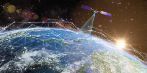
Modern technology has completely transformed map-making. Today, satellites orbiting the Earth capture detailed images of the planet. These images are combined with computer technology to create highly accurate digital maps. People can now use smartphones with GPS to find their exact location, calculate the fastest travel routes, and receive real-time traffic updates. This technology has made travel safer and more convenient than ever before.
Maps are used in many professions. Pilots use aeronautical maps to navigate aircraft safely. Sailors depend on nautical charts while travelling across oceans. Farmers use maps to manage their fields, while environmental scientists use them to study forests, rivers, and wildlife habitats. Emergency services rely on maps to reach accident sites quickly, and disaster management teams use them to plan rescue operations during floods, earthquakes, and cyclones.
Children can develop map-reading skills through enjoyable activities. Drawing maps of their neighbourhood, school, or classroom helps improve observation and spatial thinking. Treasure hunts using maps encourage teamwork and problem-solving, while learning compass directions builds geographical understanding. These simple exercises help children become confident in understanding locations and directions.
Maps also remind us that the Earth is a shared home. They show how countries, rivers, mountains, and oceans are connected. By studying maps, children learn about different cultures, climates, landscapes, and ecosystems around the world. This knowledge encourages respect for diversity and promotes global understanding.
As the famous explorer Ibn Battuta said, “Travelling—it leaves you speechless, then turns you into a storyteller.” Maps have guided countless journeys throughout history, helping people discover new places and expand human knowledge. Today, they continue to connect communities, support science, and make exploration possible. By learning to read and understand maps, children gain not only geographical knowledge but also the confidence to explore the world with curiosity, responsibility, and a spirit of adventure. Every great journey begins with knowing where you are—and a map is often the first step toward discovering something extraordinary.